Meribel piste maps
From the definition of a ‘piste’ itself, to the latest three valleys piste map, here you can find all you need when it comes to enjoying Meribel and the Three Valleys. Explore the area with ease, thanks to our downloadable Meribel and Three Valleys piste map and a number of other useful maps.
| Contents |
|---|
| What does piste mean? |
| What is a piste map? |
| How to navigate Meribel pistes |
| Meribel piste maps |
| Three Valleys piste maps |
| Other maps of Meribel |
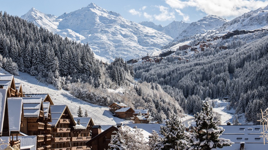
Nestled in the heart of the Three Valleys, Meribel is world renowned for its traditional alpine charm and unrivalled skiing. Meribel is the principle town of the Meribel Valley. However, the valley is in fact made up of a number of small town and villages, Mottaret, Meribel Village, La Raffort and Les Allues. Each of the villages can be access via piste, lift, road or on foot with lower villages such as Les Allues and La Raffort being linked to the main lift system by the Olympe Gondola.
Meribel is located at an altitude of 1450-1700m with Meribel-Mottaret situated higher at 1700-1800m. Being located at the heart of the Three Valleys means 600km of skiing on your doorstep, with something suitable for every experience level and an altitude of 3252m at the highest point.
Learn more about Meribel and skiing in Meribel.
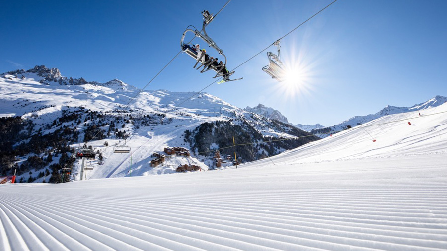
If you’re anything like us, then you’ll obsess over the snowfall reports and snow conditions prior to your trip. Along with checking the latest weather forecast, it’s useful to take time to digest the Meribel piste map along with the larger Three Valleys piste map to help plan your days on the mountain. The three valleys team strive to continually improve the ski area each year. So, even if you’ve visited before, it’s useful to check out the latest piste map each season.
We also recommend keep an eye on live lift and piste statuses, as accessibility may be limited in the event of adverse weather or piste conditions.
What does piste mean?
The word piste simply refers to a ski trail of compacted and maintained snow.
What is a piste map?
A piste map is designed to display all routes and points of interest within the given ski area. On the Three Valleys and Meribel piste maps, pistes are shown with a coloured line which can be used to identify the difficulty of the slope as below:
Green: Very easy
Blue: Easy
Red: Difficult
Black: Very difficult
Piste maps also use symbols to represent different types of ski lifts, restaurants, public toilets, first aid points and other key points of interest within a given ski area.
Ski lifts are marked with straight black lines. There are four types of ski lifts in the Three Valleys and they are abbreviated as below:
Téléski (draglift): TK
Télésiege (chairlift): TS
Télécabin (gondola): TC
Téléphénique (Cable Car): TPH
Each of the lifts also has its own symbol on the Meribel and Three Valleys maps. These can be found on the key in the bottom right hand corner. Six person, highspeed chairlifts are also prefixed “Express”.
How to navigate Meribel pistes
The best way to navigate your way around Meribel and The Three Valleys, is by choosing your ski area prior to leaving your chalet each day and identifying your route using either a Meribel or three valleys piste map. The resort is extremely well sign posted with piste names and directions at every turn. Meaning, once you have an idea of where you’re headed, you won’t need to keep reaching for your piste map. However, we recommend always taking it with you. Signs may become obstructed during heavy snowfall and on rare occasions some pistes may be forced to close meaning you have to reroute. So, it’s always useful to have your map to hand.
Meribel Piste Maps
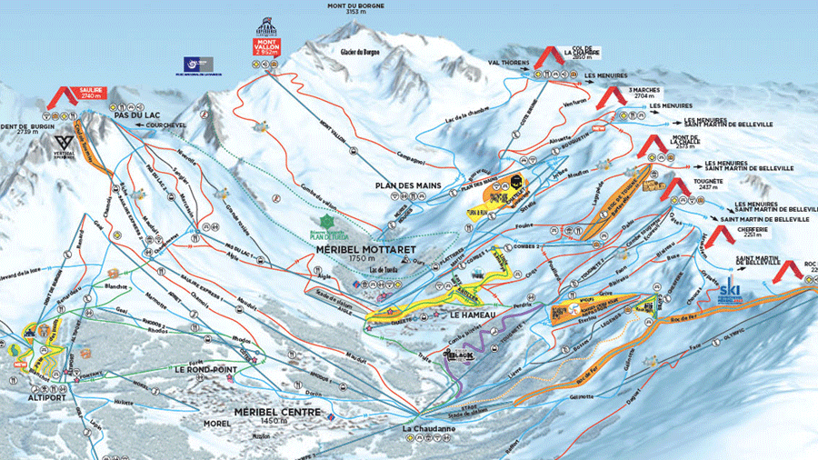
| Piste Maps (link) | Description | Perfect for… |
|---|---|---|
| Meribel Piste & Lift Map (PDF) | A static map of Meribel pistes and ski lifts. | All skiers, particularly those with a Meribel only lift pass. |
| Interactive 2D Meribel Piste & Lift Map | An interactive 2D map of Meribel pistes & ski lifts providing live lift and piste statuses as well as, access to Meribel webcams. | All skiers, particularly those with a Meribel only lift pass who want to check live lift and piste statuses. |
| Interactive 3D Meribel Piste & Lift Map | An interactive 3D map that allows you to select to view different coloured pistes, opened and close piste and lifts as well as, specific ski areas such as Snow Parks. | All skiers, particularly those with just a Meribel lift, pass who want to take a closer, more interactive look at the Meribel piste map. |
On the Meribel piste maps, pistes are shown with a coloured line which can be used to identify the difficulty of the slope as below:
Green: Very easy
Blue: Easy
Red: Difficult
Black: Very difficult
Ski lifts are marked with straight black lines. There are four types of ski lifts in the Three Valleys and they are abbreviated as below:
Téléski (draglift): TK
Télésiege (chairlift): TS
Télécabin (gondola): TC
Téléphénique (Cable Car): TPH
Each of the lifts also has its own symbol on the map. These can be found on the key in the bottom right hand corner. Six person, highspeed chairlifts are also prefixed “Express”.
Three Valleys Piste Maps
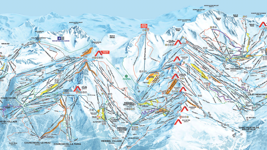
| Piste Maps (link) | Description | Perfect for… |
|---|---|---|
| Three Valleys Piste & Lift Map (PDF) | A static Three Valleys map of pistes and ski lifts across the Three Valleys. | All skiers with a Three Valleys lift pass. |
| Interactive 2D Three Valleys Piste & Lift Map | An interactive 2D map of the Three Valleys pistes & ski lifts providing live life and piste statuses as well as, access to Three Valleys webcams. | All skiers with a Three Valleys lift pass who want to check live lift and piste statuses. |
| Interactive 3D Three Valleys Piste & Lift Map | An interactive 3D map that allows you to select to view different coloured pistes, opened and closed piste and lifts as well as, specific ski areas such as Snow Parks and Three Valleys webcams. | All skiers with a Three Valleys lift pass who want to take a closer, more interactive look at the Three Valleys piste map. |
| Three Valleys Easy Rider Piste & Lift map (PDF) | A map detailing how to get around the Three Valleys using Green and Blue runs. | Skiers looking to build confidence on easier slopes but still enjoy the full Three Valleys. |
| Courchevel Piste & Lift Map (PDF) | A static Courchevel piste map, detailing pistes and ski lifts in Courchevel as well as, other key points of interest. | All skiers looking to explore the Courchevel and La Tania ski area. |
| Val Thorens Piste & Lift Map (PDF) | A static Val Thorens piste map, detailing pistes and ski lifts in Val Thorens as well as, other key points of interest. | All skiers looking to explore the Val Thorens and Orelle ski area. |
| Les Menuires & Saint Martin Piste & Lift Map (PDF) | A static Les Menuires and Saint Martin piste map, detailing pistes and ski lifts in Les Menuires and Saint Martin as well as, other key points of interest. | All skiers looking to explore the Les Menuires and charming Saint Martin ski area. |
On the Three Valleys piste maps, pistes are shown with a coloured line which can be used to identify the difficulty of the slope as below:
Green: Very easy
Blue: Easy
Red: Difficult
Black: Very difficult
Ski lifts are marked with straight black lines. There are four types of ski lifts in the Three Valleys and they are abbreviated as below:
Téléski (draglift): TK
Télésiege (chairlift): TS
Télécabin (gondola): TC
Téléphénique (Cable Car): TPH
Each of the lifts also has its own symbol on the map. These can be found on the key in the bottom right hand corner. Six person, highspeed chairlifts are also prefixed “Express”.
Other maps of Meribel
| Piste Maps (link) | Description | Perfect for… |
|---|---|---|
| Three Valleys Pedestrian Lift Map (PDF) | A static map outlining the very best of the Three Valleys on foot. | Non-skiers in Meribel looking to explore the Three Valleys on foot. |
| Meribel winter walking trails map (PDF) | A detailed guide and static map of Meribel’s best winter walking trails. | Non-skiers in Meribel looking to enjoy the very best of Meribel, right on their doorstep on foot or with snowshoes. |
| Brides les Bains map (PDF) | A static map of the charming Bride les Bains. | Non-skiers and skiers alike looking to travel down the mountain explore the beautiful towns in and around Meribel. |
Visit our chalet page to take a look at our chalets in Meribel. Or take a glance at their remaining availability and book now. For helpful information on travelling to Meribel, see our guide.
Meribel Skiing facts & figures
600km of pistes
328 downhill skiing pistes
2500 hectares of skiable terrain
85% of runs above 1800m
Highest peak 3252m
200 lifts
More than 2,100 snow canons
2 snow parks
Skiing Meribel by Level
Beginner: 45 green runs
Intermediate: 117 blue runs, 101 red runs
Advanced: 27 black runs
Off-Piste Activities in Meribel
Picturesque Walks
Shopping
Movies
Bowling
Pampering
Wine Tasting
Ice Skating
Museum
Cafes/bars
Swimming
Sightseeing
All the Ski Basics staff were a credit to their company! The host and chef were really friendly and the drivers are happy to help! Thank you very much for having us.
Ben Forrester - December, 2021