Meribel Piste Map
Whether you're looking for official Méribel piste maps or more general trail maps of the Three Valleys, we've got you covered.
Explore the area with ease, thanks to our downloadable Meribel and The Three Valleys piste maps, and a number of other useful maps.
VIEW THE 2026 MERIBEL PISTE MAP (PDF)
VIEW THE 2026 THREE VALLEYS PISTE MAP (PDF)
About Meribel
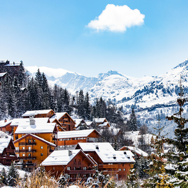
Nestled in the heart of The Three Valleys, Meribel is famed for its alpine charm and excellent skiing. It is the principal town of the Meribel Valley, which includes Mottaret, Meribel Village, La Raffort, and Les Allues. These villages are accessible by piste, lift, road, or on foot, with Les Allues and La Raffort connected to the main lift system by the Olympe Gondola.
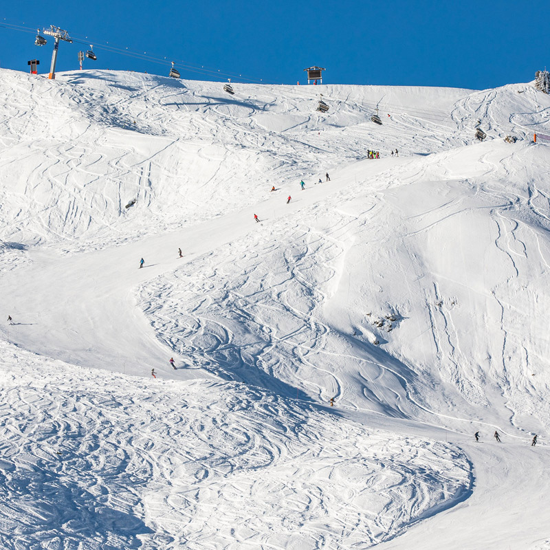
Meribel sits at an altitude of 1450-1700m, while Meribel-Mottaret is higher at 1700-1800m. The Three Valleys offer 600km of skiing, catering to all experience levels, with the highest point at 3252m.
If you’re anything like us, then you’ll obsess over the snowfall reports and snow conditions prior to your trip.
Along with checking the latest weather forecast, it’s useful to take time to digest the Meribel piste map along with the larger Three Valleys piste map to help plan your days on the mountain.
The three valleys team strive to continually improve the ski area each year. So, even if you’ve visited before, it’s useful to check out the latest piste map each season.
Explore the area with ease, thanks to our downloadable Meribel and Three Valleys piste maps, and a number of other useful maps.
What does piste mean?
The word 'piste' simply refers to a ski trail of compacted and maintained snow, and is a marked ski run or path down a mountain for skiing, snowboarding, or other mountain sports.
What is a piste map?
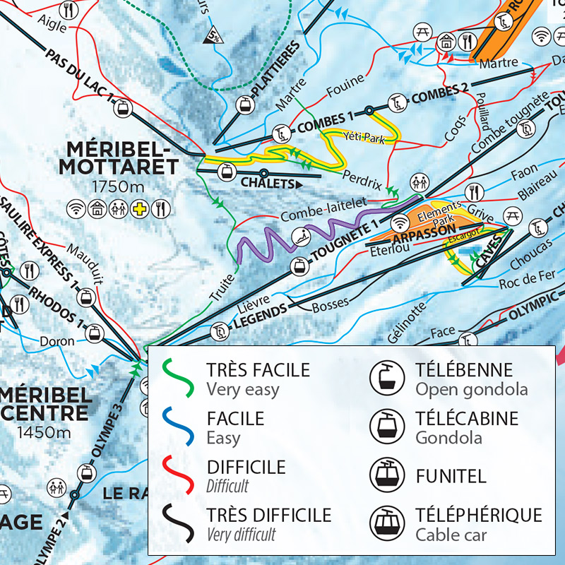
A piste map is designed to display all routes and points of interest within a given ski area. On The Three Valleys and Meribel piste maps, pistes are shown with a coloured line which can be used to identify the difficulty of the slope.
How to read a piste map
Pistes are shown with a coloured line which can be used to identify the difficulty of the slope as follows:
Green: Very easy,
Blue: Easy,
Red: Difficult, and
Black: Very difficult.
Ski lifts are marked with straight black lines. There are four types of ski lifts in The Three Valleys as follows: Télébenne (Open gondola), Télécabine (Gondola), Funitel, and Téléphérique (Cable car).
Each of the lifts also has its own symbol which can be found on the key in the bottom right-hand corner of the map. Six person, high speed, chairlifts are also prefixed 'Express'.
How to navigate Meribel pistes
The best way to navigate your way around Meribel and The Three Valleys, is by choosing your ski area prior to leaving your chalet each day and identifying your route using either a Meribel or Three Valleys piste map.
The resort is extremely well sign posted with piste names and directions at every turn. Meaning, once you have an idea of where you’re headed, you won’t need to keep reaching for your piste map. However, we recommend always taking it with you. Signs may become obstructed during heavy snowfall and on rare occasions some pistes may be forced to close meaning you have to reroute. So, it’s always useful to have your map to hand.
| Piste map (link) | Description | Perfect for… |
|---|---|---|
| Piste map (link) | Description | Perfect for… |
| 2026 Meribel piste & lift map (PDF) | A static map of Meribel pistes and ski lifts. | All skiers with a Meribel lift pass. |
| Interactive 2D Meribel piste & lift map | An interactive 2D map of Meribel pistes and ski lifts providing live lift and piste statuses as well as access to Meribel webcams. | All skiers with a Meribel lift pass who want to check live lift and piste statuses. |
| Interactive 3D Meribel piste & lift map | An interactive 3D map that allows you to select and view different coloured pistes, opened and close pistes and lifts, as well as specific ski areas such as snow parks. | All skiers with a Meribel lift pass who want to take a closer, more interactive, look at the Meribel's pistes. |
| Piste map (link) | Description | Perfect for… |
|---|---|---|
| Piste map (link) | Description | Perfect for… |
| 2026 Three Valleys piste & lift map (PDF) | A static Three Valleys map of pistes and ski lifts across The Three Valleys. | All skiers with a Three Valleys lift pass. |
| Interactive 2D Three Valleys piste & lift map | An interactive 2D map of The Three Valleys pistes and ski lifts providing live lift and piste statuses as well as access to Three Valleys webcams. | All skiers with a Three Valleys lift pass who want to check live lift and piste statuses. |
| Interactive 3D Three Valleys piste & lift map | An interactive 3D map that allows you to select to view different coloured pistes, opened and closed pistes and lifts, as well as specific ski areas such as snow parks and Three Valleys webcams. | All skiers with a Three Valleys lift pass who want to take a closer, more interactive, look at The Three Valleys pistes. |
| 2026 Three Valleys 'Easy Rider' piste & lift map (PDF) | A map detailing how to get around The Three Valleys using just Green and Blue runs. | Skiers looking to build confidence on easier slopes but still enjoy the full Three Valleys. |
Size of the ski area
150 km of marked pistes (600 km with the full Three Valleys pass).
Altitude
1,300 m – 2,738 m.
Why ski here?
Wide, perfectly groomed greens and blues for confidence-building, plus the steep Couloirs of Saulire for experts.
| Piste map (link) | Description | Perfect for… |
|---|---|---|
| Piste map (link) | Description | Perfect for… |
| 2026 Courchevel piste & lift map (PDF) | A static Courchevel piste map detailing pistes and ski lifts in Courchevel as well as other key points of interest. | All skiers looking to explore the Courchevel and La Tania ski area. |
Size of the ski area
160 km (largest single valley of The Three Valleys).
Altitude
1,800 m – 3,230 m, the highest resort in Europe, giving excellent early and late-season snow.
Why ski here?
Two glacier sectors and plenty of freeride terrain between marked runs.
| Piste map (link) | Description | Perfect for… |
|---|---|---|
| Piste map (link) | Description | Perfect for… |
| 2026 Val Thorens piste & lift map (PDF) | A static Val Thorens piste map detailing pistes and ski lifts in Val Thorens as well as other key points of interest. | All skiers looking to explore the Val Thorens and Orelle ski area. |
| Map (link) | Description | Perfect for… |
|---|---|---|
| Map (link) | Description | Perfect for… |
| 2026 Three Valleys pedestrian lift map (PDF) | A static map outlining the very best of The Three Valleys on foot. | Non-skiers looking to explore The Three Valleys on foot. |
| 2026 Meribel winter walking trails map (PDF) | A detailed guide and static map of Meribel’s best winter walking trails. | Non-skiers in Meribel looking to enjoy the very best of Meribel, right on their doorstep on foot or with snowshoes. |
| 2026 Brides les Bains map (PDF) | A static map of the charming Bride les Bains. | Non-skiers and skiers alike looking to travel down the mountain explore the beautiful towns in and around Meribel. |
Meribel piste opening dates
While the exact calendar shifts a little each winter, you can plan on the lifts (and therefore the pistes) opening usually from the second weekend in December right through to the final week of April. In a typical season that means:
- Opening: around 6-8 December, when the Courchevel and Méribel Valleys of the Three Valleys generally welcome their first skiers
- Closing: around 21 April, with the fully linked area (Courchevel, Méribel and Val Thorens) staying open until then, and Val Thorens often extending into early May for late-season turns
Do keep an eye on the official lift bulletin as exact dates are confirmed each autumn and can be brought forward or pushed back if Mother Nature delivers exceptional early (or late) snowfall.
Mirroring the Meribel piste and trial opening times, we will almost always welcome our first guests on the second weekend of December and our last on the final weekend of April, making for a long and enjoyable season.
Ready to go skiing in Meribel?
As well as outstanding skiing and superb snow, Meribel is a beautiful resort to spend your holiday. With its breathtaking traditional style, stunning scenery, bustling apres-ski and great shopping, skiers and non-skiers will have a fantastic holiday in Meribel.
We offer both catered and self-catered ski chalet options to suit various budgets and ensure maximum flexibility. With over 20 years of experience in providing great value chalet holidays, we are passionate about great skiing and know Meribel and The Three Valleys inside out.